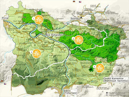
On trails that are marked as bike tracks, you can eventfully “experience” the natural environment of the Saxon Switzerland National Park on over 50 km. The bike routes are forest and forestry roads that, in contrast to most cycle tracks, are not paved and in some cases rather narrow. In some places cyclists can encounter some steeply ascending slopes. Especially in the steep sections, you should be prepared for deep bumps in the ground or transverse timber logs (serving for water drainage). Very importantly, these tracks are also marked hiking trails where hikers have full “right of way”. Green signs with yellow writing “cycling route” and a bike logo mark the cycle tracks in the area. These routes provide access to the national Elbe Cycle Path, cycle/hiking trails left and right of the river, and the Bohemian bike tracks network (marked yellow and often well paved).
You can access current maps of the itineraries of the National Park Region with the links below.
|
Cycle maps by area |
|

More advice: Start your tour in the National Park Region on a bike bus! These buses take you and your bicycle to the best starting points – and onto some mountains.
Highlight
Since wild animals are very susceptible to interference and react to fast passing cyclists a lot more than to slow movements, especially at dusk and night time, cycling during these times should be generally avoided in the National Park. Incidentally, the tracks may be used on any mountain bike, but there are no further MTB or downhill trails in the National Park.


