 Hiking recommendations:
From Königstein (ferry to Halbestadt) via the south ascent to Lilienstein – Plateau – descent on the northern route to Bad Schandau to the S-Bahn. From bus stop Waltersdorf hike via the north ascent to Lilienstein. From train stop Rathen – Kottesteig via north ascent to Lilienstein, descent via the southern route to Königstein to the S-Bahn
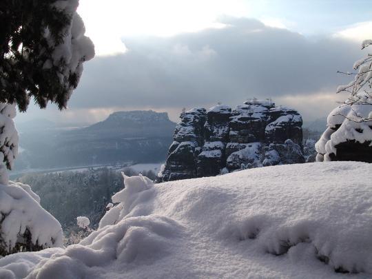
Located at the heart of Saxon Switzerland National Park the only mesa to the right of the Elbe river has a striking silhouette. We have chosen this well-known shape of Lilienstein as our National Park logo. Even from afar Lilienstein greets its guests. High above the Elbe Valley, opposite the Königstein fortress, the sandstone mesa rises 415 m above the landscape. From whatever direction Lilienstein is seen – it always reveals a different shape. When traveling by train along the large Elbe curve between Rathen and Königstein you can best marvel at this rock with its size and grandeur from almost all perspectives. Some very nice Elbe Valley views and an inn are located on the plateau.
Getting there:
With the S-Bahn to Königstein
By bus to Waltersdorf (line 253)
By car to the parking lot below Lilienstein (access via Waltersdorf), from there you can walk to the summit.
Historical notes: Remains of a castle wall from 1379, fragments of pottery and weapons discoveries from the 16th century have revealed that Lilienstein was an inhabited mountain. What is interesting is the game of nine men’s morris from the 16th century that was carved into the rock wall of the ruins. Whether it was used by the castle guards, prisoners or residents will probably remain a mystery to us. In 1708 Augustus the Strong, Elector of Saxony and King of Poland, ascended the mountain and had steps cut into the south side; the north ascent was only built in 1900.


